How to get to Granite Lake and Maggie's Peaks, South Lake Tahoe
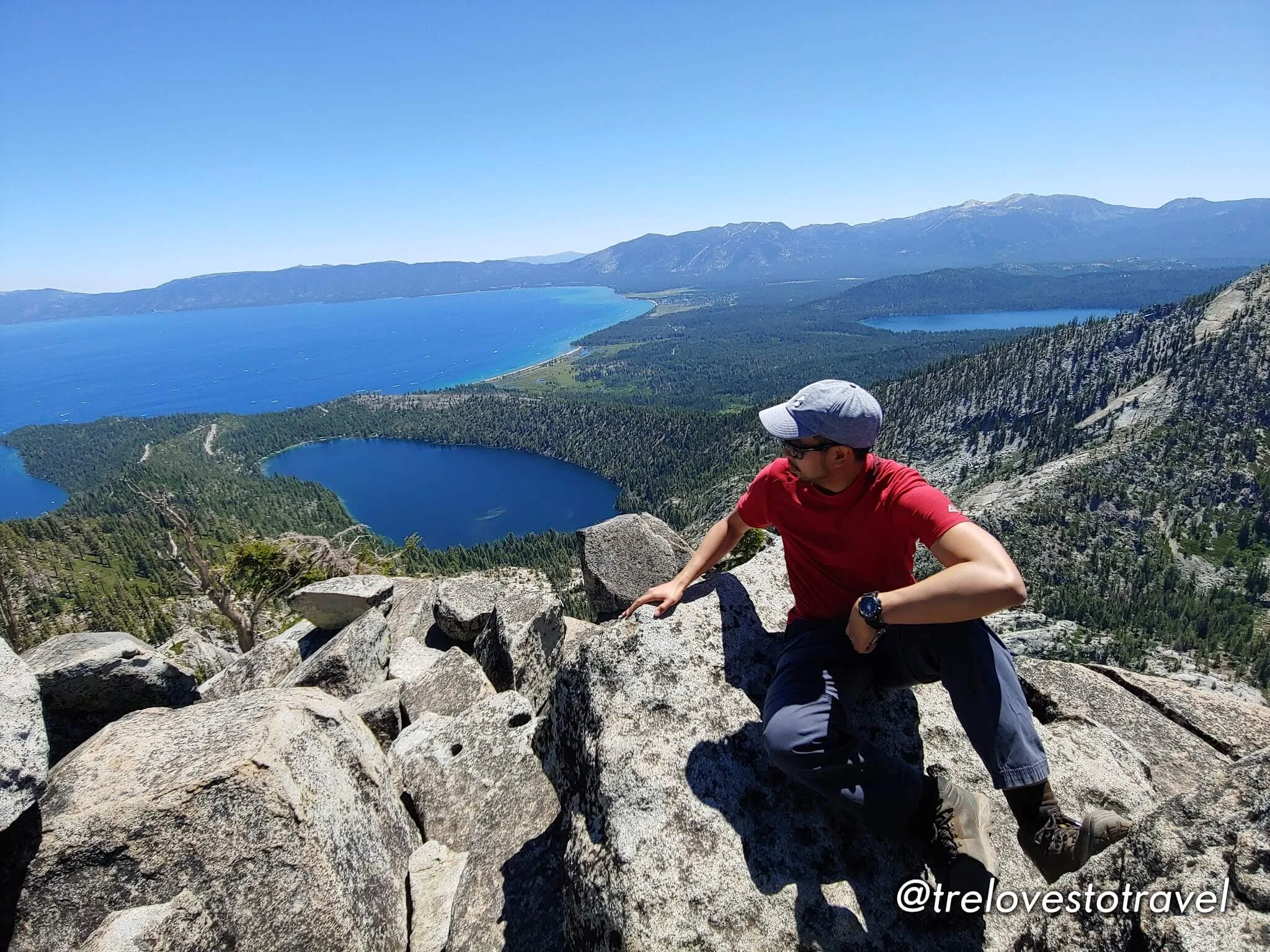
Maggie's Peak is not your ordinary hike in South Lake Tahoe. The trail is challenging yet manageable and unbelievably breathtaking once you reach the top. It is situated in the Sierra Nevada Mountian range and it offers a magnificent panoramic view of Lake Tahoe. Let’s go!
"This site contains Affiliate links and as an Amazon Associate, I earn from qualifying purchases of a product/service at no added cost to you." ^_^
Travel Tips
- For flights, Skyscanner is excellent for comparing the best airline deals.
- For accommodations, our family trusts Booking.com for reasonable prices.
- Organize your trips easily with a Travel Planner.
- For tried-and-true travel and hiking gear, check out our Amazon Storefront.
DRIVE

Travel time from Los Angeles to South Lake Tahoe: 7 hours and 30 minutes
WHERE TO STAY

- Check-in: Bluelake Inn @ Heavenly Village
- Address: 944 Friday Avenue, South Lake Tahoe, CA 96150
- 3 days, 2 nights: 606.32 USD (with breakfast)
Staying close to Heavenly Village also gives you access to dining, shopping, and entertainment in South Lake Tahoe.
From Bluelake Inn to Inspiration Point Vista, which is the entry point to Maggie's Peak is 30 minutes.
How to get there:
Location: Bayview Campground, South Lake Tahoe, CA 96150
Entrance fee: Free
Parking: Free
Route: Granite Lake and Maggie's Peaks
Duration: 5-6 hours (back and forth, depending on pace)
Elevation : 1,761 feet
Highlights: Snack/Swim at Granite Lake and Panoramic views of South Lake Tahoe
PARKING

Three options for parking:
1. Park here for free at Inspiration Point Visa. There's a limited parking spot but we were lucky to get one. There is an available restroom too that you can use before starting your hike.
2. Limited street parking across the road outside Bayview Campground.
3. Park free inside Bayview Campground.
HIKE STARTS HERE AT BAYVIEW CAMPGROUND

The hike going to Maggie's Peak starts here at Bayview Campground.
PERMIT

Normally you need a Permit to start your hike. A very simple task by fill out a small registration paper provided and then drop it off in the small brown box. However, due to COVID, no permit was required for that day.

The first part of the hike is getting to Granite Lake and then hiking more further to reach South Maggie's Peak.
TURN TO DESOLATION WILDERNESS

From here turn right to Desolation Trail
Bayview Campground is the main entry point to Cascade Falls Hiking Trail or Bayview Hiking Trail. Also, further down the road from Inspiration Point are two other trails that lead to Vikingsholm Castle or Eagle Falls Lake.


First lookout. There's really nothing much to see here just a spot to take a break.

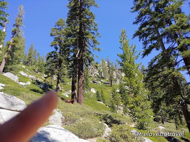
These rocks on the right look like they have noses in them.
We took a short snack break to get ready for the real hike. There are no arrows along the trail so make sure you hike early in the morning to give yourself enough time to get lost.


Keep going uphill. From here on your left side, you'll see a giant rock that looks like a spartan helmet. Check it out!

From here the trail is shaded with tall trees.
GRANITE LAKE

Touchdown Granite Lake! The lake is beautiful!

It's one of the most beautiful lakes I've ever seen aside from the lake in Tobermory in Canada.


Look at that beauty!

Granite Lake was mesmerizing. The waters glistened as the sun's rays hit the water. I was satisfied and even told my husband that I could go back to town now and have a lunch buffet.


It's a good deal of uphill climb. We really worked on our calves that day. You're going to see wooden steps every now and then, which is a fabulous indicator that you're heading on the right path.

See that little figure there? Yeah! That's a big man taking a break and we're hiking all the way up there.

Don't forget to have fun. High five to my hiker buddy and also the love of my life!

Take a break. Remember that when you start to feel thirsty you're already dehydrated.

Hydra Trees! These trees remind me of Hydra from the Godzilla Movie.

Don't forget to enjoy the view!

Show some love. Hug a tree!

I like this path! It may seem like nothing in the picture as the angle made it look flat. It's actually a single-lane trail with a dangerous fall and an amazing rock formation on the other side.
From here there's no clear path. Most hikers went straight following the clear, paved trail. Also, when we reached the top I noticed everyone came in different ways, they-made-up-trail. I remembered that big man taking a break who was ahead of us made it to the top a bit later when we got there, and he told himself, out loud, "Oh, I guess I made a wrong turn huh."


Hiking tip: Invest in reliable hiking boots for comfort and safety. Check out our Favorite and Trusted Hiking Gears


Little did we know, according to our alltrails map, Maggie's Peak is a few minutes away from this area. We kinda saw it as we peek on our left to see some other ledge rocks coming out in the open. But we were fully satisfied, whatever Maggie Peak offers is already out there in front of us, just a point of perspective.


Back to my favorite path! And here we have hubby trying out his "Kame Hame Ha" wave powers to move a little fraction of this rock. It's a term used in this famous Anime Series called Dragon Ball, a powerful attack that produces an explosive beam of energy.


Back to Granite Lake for late lunch. Hello again to the biggest and tallest tree I've ever seen from this hike. We're a huge fan of Vienna sausage and then pairing it up with a peanut butter sandwich, some beef jerky, and lots of water is like heaven on earth after a challenging hike. The path heading back to the parking area is a piece of cake from here.

This is where I end this post. We are as happy as we can be. A great day to celebrate my husband's birthday. It's not all cakes and beers but I hope it filled his wanderlust soul with many splendid memories of South Lake Tahoe.
Make sure to check the latest update at Tahoe South Blog before driving to your destination.
Have fun and be safe ^__^
Do you want more adventure?
If you still have one more day check out: Things to Do in South Lake Tahoe, California.
Where am I going next?
My next adventure is hiking at Yosemite National Park, which is considered one of California's Most Beautiful National Parks - CANCELED due to the fire. Instead of hiking, we're visiting a hidden gem, the historic Danish village of Solvang in Santa Ynez, California.
Related articles you may find interesting:


No comments
Post a Comment