Beginner Hikes in Southern California
There is so much beauty in this world and we all need to go out and find this bliss. We find the wonders of nature when we're hiking. We are not experienced hikers, we feel like we're still beginners but we know the basics and still learning along the way. Our hikes are always a mix of exploring a mountain, an overlook, and a short beach trail and we also go the extra mile every now and then. We have here a list of the best hiking trails we've done in California. Let's go!
"This site contains Affiliate links and as an Amazon Associate, I earn from qualifying purchases of a product/service at no added cost to you." ^_^
Travel Tips
- For flights, Skyscanner is excellent for comparing the best airline deals.
- For accommodations, our family trusts Booking.com for reasonable prices.
- Organize your trips easily with a Travel Planner.
- For tried-and-true travel and hiking gear, check out our Amazon Storefront.
Essential Tips for a Safe and Enjoyable Hike
Before you embark on your next hike, remember to prioritize safety and comfort. Here are two tips to keep in mind:
- Hiking Tip 1: Invest in Sunglasses Suitable for All Outdoor Activities.
For those who enjoy outdoor activities, we highly suggest the Polarized Hiking Sunglasses from Decathlon. Featuring anti-UV lenses, these sunglasses effectively block all UVA and UVB rays, protecting your eyes from the sun's harmful rays. The polarized lenses are also designed to reduce glare and provide a clear view of your surroundings. The wrap-around design offers extra coverage, and the rubber tips ensure the glasses stay in place during intense activities like hiking, running, and cycling. Learn more: Most Affordable Sunglasses For UV Protection And Polarized Lenses
- Hiking Tip 2: Prioritize your Comfort and Safety by Investing in Reliable Hiking Boots.
We have a toddler and his been loving his new Timberland Toddler hiking shoes, which have kept his ankles safe as he hops and plays during our hikes. Meanwhile, we've been relying on our trusty Columbia Men's and Columbia Women's Hiking Boots since 2019, and they continue to be durable and dependable companions on our hikes.
Favorite Hikes in Southern California: Los Angeles County Hikes
We've compiled a list of our top favorite hikes in Southern California, including beach hikes, national parks, botanical parks, state parks and national parks.
Eaton Canyon Natural Area Park and Nature Center
Address: 1750 N Altadena Dr, Pasadena, CA 91107
Entrance fee: Free
Parking: Free
Distance: 3.5 miles (back and forth)
Elevation: 436 feet
Duration: 3 hours and 30 minutes (back and forth, depending on pace)
How to get there:
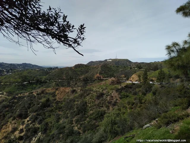
Charlie Turner Trail or Mount Hollywood Trail
Address: 2840 W Observatory Rd, Los Angeles, CA 90027
Entrance fee: Free
Parking: Griffith Observatory $3 for every hour
Distance: 3 miles (4.83 km, back and forth)
Elevation: 800 feet
Duration: 2-3 hours (back and forth, depending on pace)
How to get there:
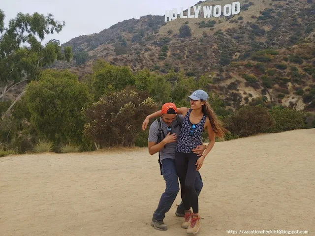
Brush Canyon Trailhead
Address: Canyon Dr, Los Angeles, CA 90068
Entrance fee: Free
Parking: Free
Distance: From Brush Canyon Trailhead, 1.9 miles to the back of the Hollywood sign and 2.3 miles to the front sign
Elevation: 725 feet
Duration: 4 hours (back and forth, depending on pace)
Address: 1 Moccasin Trail, Palmdale, CA 93550
Entrance Fee: Free
Parking: Free at trail Entrance (close to Chilao Visitor Center)
Distance: 6.8 miles
Elevation: 1,194 feet
Duration: 3 hours (back and forth)
How to get there:
Los Liones Canyon Trailhead
Address: Paseo Miramar Trail, Malibu, CA 90265
Entrance fee: Free
Parking: Free
Distance: 4.9 miles
Elevation: 1,171 feet
Duration: 3 hours (back and forth, depending on pace)
How to get there:
Address: Switzer Picnic Area, Switzer Truck Trail, Altadena, CA 91001
Entrance fee: Free
Parking: Adventure Pass needed (purchase @Big 5 Sporting Goods)
Distance: 4.3 miles (back and forth)
Elevation: 725 feet
Duration: 3 hours (back and forth, depending on pace)
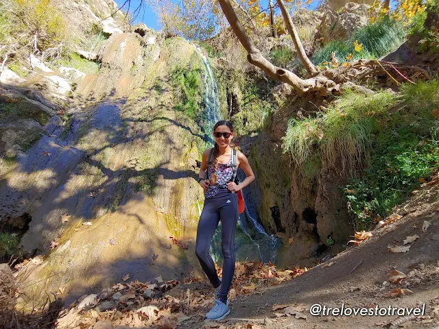
How to get there:
Escondido Canyon Trail
Address: Escondido Canyon Trail, Malibu, CA 90265
Entrance fee: Free
Parking: Two options 1.Free street parking along PCH 1 near the park entrance with a sign that says "Winding Way Trail to Escondido Falls" or 2. drive through the sign and park inside for 8 USD.
Distance: 3.8 miles (back and forth)
Duration: 3 - 4 hours (back and forth, depending on pace)
Elevation: 626 feet
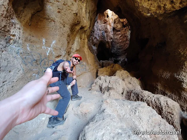
How to get there: Cave of Munits
El Escorpion trailhead
Address: 24501 Vanowen St, West Hills, CA 91307
Entrance fee: Free
Parking: Free
Distance: 1.8 miles loop (back and forth)
Duration: 1 hour (back and forth, depending on pace)
Elevation: 308 feet
Address: 7001 Smith Rd, Simi Valley, CA 93063
Entrance fee: Free
Parking: Free
Distance: 1.7 miles loop (back and forth)
Elevation: 259 feet
Duration: 1 hour (back and forth, depending on pace)
10. Malibu Creek State Park
How to get there:
Address: 1925 Las Virgenes Rd, Calabasas, CA 91302
Entrance and Parking fee: 12 USD for admission and for whole-day parking
11. O'Melveny Nature Trail Loop
How to get there:
Address: O'Melveny Park, Sesnon Boulevard, Granada Hills, CA
Entrance fee: Free
Parking: Free
Distance: 1.6 miles loop (back and forth)
Elevation: 252 feet
Duration: 1 hour (back and forth, depending on pace)
How to get there: Cistern Trail to Lookout Trail
Address: Cistern Trail Parking, Mulholland Hwy, Calabasas, CA 91301
Entrance fee: Free
Parking: Free side road parking
Route: Cistern Trail to Lookout Trail
Distance: 1.3 miles (out and back)
Duration: 45 minutes - 1 hour
Elevation: 390 feet
Highlights: Up close with the Santa Monica Mountains and overlooking Century Lake
How to get there: Charmlee Wilderness Park
Location: 2577 Encinal Canyon Rd, Malibu, CA 90265
Entrance fee: Free
Parking: Normally 4 USD for day use ( but when we went there last August 2023 no fee was charged)
Route: Ocean Overlook Loop Trail
Distance: 2.6 miles (out and back)
Duration: 1 hour and 15 minutes
Elevation: 462 feet
Highlights: Panoramic ocean views
Short Easy Beach Hikes and Walks
- A walk can be a hike if it's longer and increases the pace of walking.
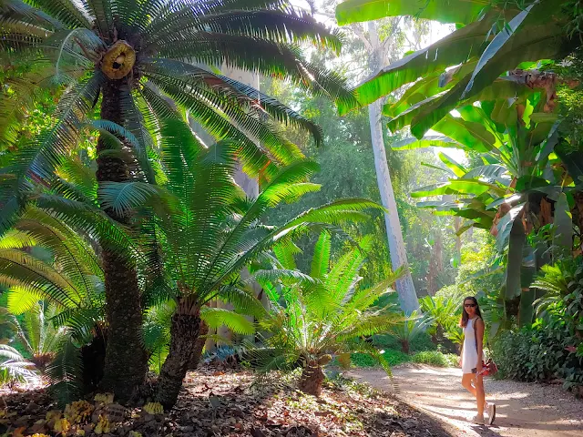
14. Los Angeles Arboretum Trail
How to get there:
Address: 301 North Baldwin AvenueArcadia, CA, 91007
Entrance fee: Adults: USD 15, Students and Seniors: USD 11, Ages 5-12: USD 5 and 4 and under is free
Parking: Free
Distance: 1.8 miles loop (back and forth)
Elevation: 121 feet
Duration: 1-2 hours (back and forth, depending on pace)
Address: 5970 Palos Verdes Dr S, Rancho Palos Verdes, CA 90275
Entrance fee: Free
Parking: Pay Parking or Street Parking (First 30 Minutes is FREE, 6 USD for 30 minutes to 2 hours and 12 USD for over than 2 hours parking)
Route: Abalone Cove Reserve via Sea Dahlia Trail, Portuguese Viewpoint, and Olmsted Trail
Distance: 1.4 miles loop (back and forth), we might have done more as we went to check out some other trails.
Duration: 2 hours (back and forth, depending on pace)
Elevation: 269 feet
16. Point Dume Beach via Point Dume Cove Trail
How to get there:
Point Dume State Beach
Address: 6800 Westward Beach Rd, Malibu, CA 90265
Entrance fee: Free
Parking: 6 USD
Distance: 1.4 miles (back and forth)
Elevation: 347 feet
17. El Matador, La Piedra and El Pescador State Beaches
How to get there
El Matador Beach
Address: 32350 Pacific Coast Hwy, Malibu, CA 90265
Entrance fee: Free
Parking: 8 USD or park on the Pacific Coast Highway for free
Distance: 2.4 miles (back and forth)
Elevation: 154 feet
18. Venice Beach and Venice Boardwalk
How to get there:
Address: Venice Beach, 90291
Entrance fee: Free
Parking: 5 USD - 15 USD, depending on season or Street parking in the residential area for free
19. Will Rogers State Beach
How to get there:
Will Rogers State Beach
Address: 17000 CA-1, Pacific Palisades, CA 90272
Entrance fee: Free
Parking: 6 USD
20. Hermosa Beach
How to get there:
Hermosa Beach
Address: Hermosa Beach, CA 90254
Entrance fee: Free
Parking: 3 USD - 30 USD or Street parking for free
21. Santa Monica Pier
How to get there:
Santa Monica Pier
Address: 200 Santa Monica Pier, Santa Monica, CA 90401
Entrance fee: Free
Parking: Find a parking structure 3 USD - 20 USD
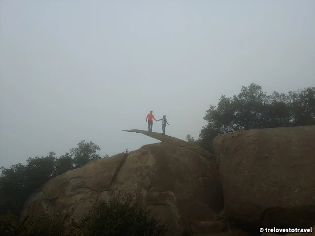
- Testing your limits makes life interesting.
How to get there:
Potato Chip Rock in San Diego
Address: Mount Woodson Trail, Poway, CA 92064
Entrance fee & Parking: 10 USD
Distance: 7.5 miles (back and forth)
Elevation: 1,220 feet
Duration: 3-4 hours (back and forth, depending on pace)
How to get there: Bayview Campground
Address: Bayview Campground, South Lake Tahoe, CA 96150
Entrance fee: Free
Parking: Free
Distance: Estimate around 5-6 miles loop (back and forth)
Duration: 5-6 hours (back and forth, depending on pace)
Elevation: 1,761 feet
How to get there:
Location: Crystal Lake Trailhead, Inyo National Forest, Lk George Rd, Mammoth Lakes, CA 93546
Entrance fee: Free
Entrance fee: Free
Parking: Free Trailhead Parking
Route: Crystal Lake Trailhead
Distance: 3.2 miles (out and back)
Duration: 1 hour and 48 minutes
Elevation: 839 ft
Highlights: As you ascend, enjoy stunning views of Lake George and Lake Mary. But the true gem is Crystal Lake, boasting a picturesque backdrop of snow-capped mountains that will take your breath away.
Easy Hikes: Outside of Los Angeles County
- Easy enough to Hike with a Baby
.jpg)
How to get there: Champion Lodgepole Trail
Beware: You must use a 4-wheel drive going up the mountain. Driving up the mountain was not a joke. Expect rocky roads and a very wild, bumpy ride.
Location: Champion Lodgepole Pine Trail (1W11)
Entrance fee: Free
Parking: Street Parking
Distance: 1 mile (out and back)
Duration: 30-45 minutes
Elevation: 7,500 feet
Highlights: Largest Lodgepole Pine trees in the world.
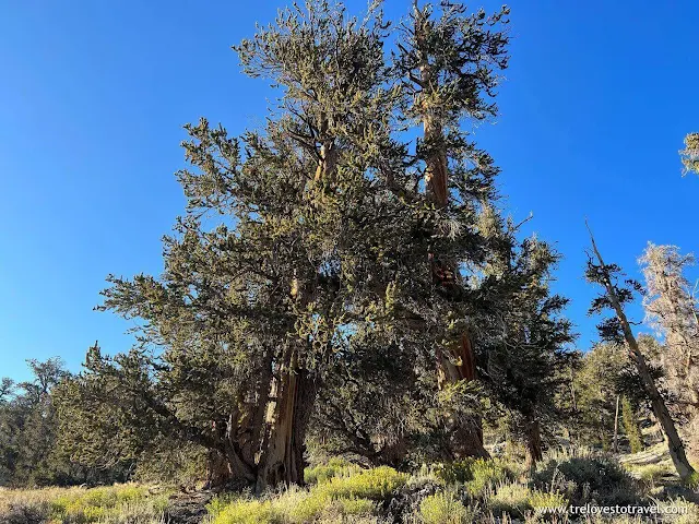
How to get there: near the Ancient Bristlecone Visitor Center
Location: White Mountain Rd, Bishop, CA 93514
Entrance fee: 3 USD per person, max of 6 USD per car
Parking: Free Trailhead Parking
Route: Schulman Grove Discovery
Route: Schulman Grove Discovery
Distance: 0.9 miles (Loop)
Duration: 32 minutes
Duration: 32 minutes
Elevation: 265 ft
Highlights: Oldest Trees in the World
Highlights: Oldest Trees in the World
Reminders: We left before dark as the roads are narrow and winding and definitely should try to avoid driving at night.
How to get there:
Mono Lake
Address: Mono Lake Navy Beach Osprey Observation Point Lee Vining, CA 93541
Address: Mono Lake Navy Beach Osprey Observation Point Lee Vining, CA 93541
Southern California's National Parks
- Add more spice to your hiking life by camping and biking in National parks.
How to get there:
Grand Canyon Visitor Center
Address: S Entrance Rd, Grand Canyon Village, AZ 86023
Entrance fee: 35 USD per car or purchase the "America the Beautiful Pass" for 80 USD which allows you access to different national parks for a year
Parking:
Lot 1: close to Grand Canyon views. RV spaces/vehicles with trailers.
Lot 2: Grand Canyon Visitor Center/ Market Plaza. No RV spaces.
Lot 3: short walk to the Visitor Center/ Market Plaza. No RV spaces.
Lot 4: more parking spaces. Bicycle Rental & Café, Bookstore and Visitor Center / Plaza. No RV spaces.
How to get there:
Yosemite Valley Visitor Center
Address: 9035 Village Dr, Yosemite Valley, CA 95389
Entrance fee: 35 USD per car or purchase the "America the Beautiful Pass" for 80 USD, allowing you to access different national parks for a year.
.jpg)
How to get there:
Foothills Visitor Center
Address: 47050 Generals Hwy, Three Rivers, CA 93271
Entrance fee: 35 USD per car or purchase the "America the Beautiful Pass" for 80 USD which allows you access to different national parks for a year
Have fun and be safe ^__^
Do you want reliable gear for adventure?
Where am I going next?
My next adventure is to another U.S. state situated in the Pacific Ocean, the Beautiful Island of Hawaii.
Related articles you may find interesting:












No comments
Post a Comment